You’ve probably seen photographs of the Perito Moreno Glacier. One of the most photogenic glaciers in the world, the Perito Moreno is a site to behold. And behold we did. It was one of the final scenic stops on our trip to Patagonia in southern Argentina, and it was worth the wait. I took hundreds of photographs, so picking the few that I use below was difficult. There will be more in the future, but let’s at least get in some of the highlights. Driving along the Peninsula Magallanes, we rounded a turn and, as a group, in unison, all exclaimed, “Wow!,” as we saw this:
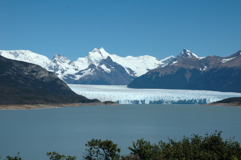
Unlike many of the glaciers we had already encountered on the trip, this one is both massive and dramatically intrudes onto the lakes. If you look closely at the photo above, near the shore in the middle right, you’ll see a boat. That boat is roughly the length of the boats that take you into the mist at Niagara Falls. Luckily there was no mist (as it would have been ice cubes), for we were about to go on that boat right up close to the south face of the glacier. The north face, which I’ll get to later in this piece, is just off the right side of the above photo. Staying on this side for now, this is what the south face looks like up close.
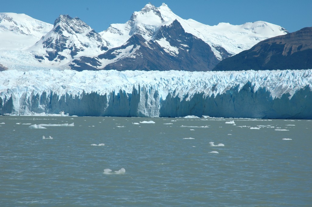
To give you some perspective, those mountains in the background are between 2100 and 3000 meters high (6900 to 9800 feet). The face of the glacier runs about 50-55 meters above the waterline (165-180 feet), but remember that most of an iceberg is below water? Well, the total depth of the ice is actually more like 150 meters (nearly 500 feet). To get a really intimate look we decided to nudge up closer:
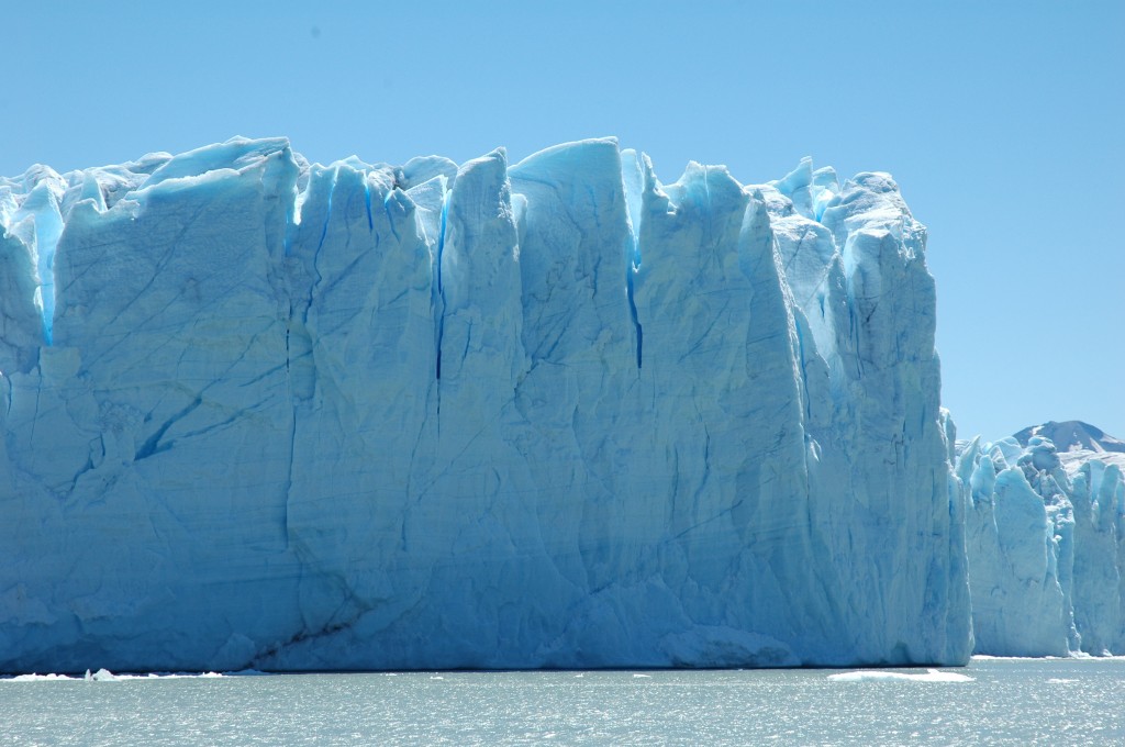
Imagine that much ice hovering over your head. Here’s another close up shot:
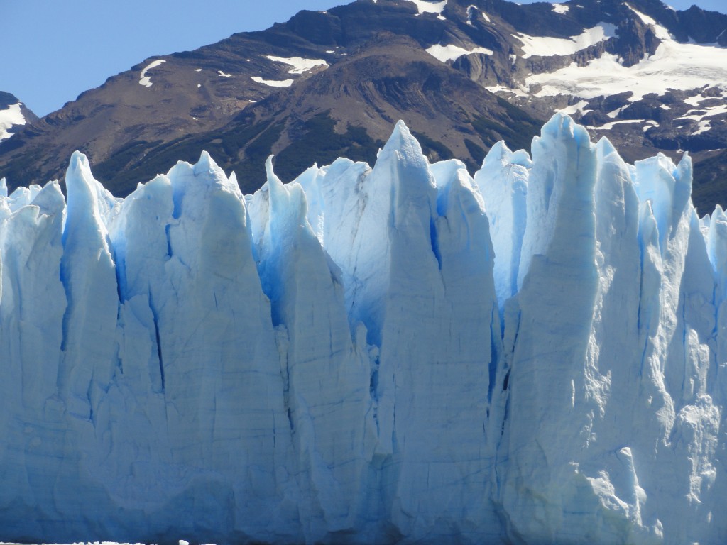
You can see how uneven and ragged the surface is of the glacier. Even more amazing, you can hear it. There is constant groaning and popping and cracking from all over the glacier. Every so often a chunk falls off into the water. And by chunk I mean anything ranging from small (the size of your chair) to medium (your car) to large (your house).
Okay, enough of the south face. Let’s get back onshore and drive around the point to the front and north faces of the Perito Moreno glacier. Look back at the first photo in this post; we’re going off to the right, around that little point of land in the middle. This is the first view you’ll have when you arrive:
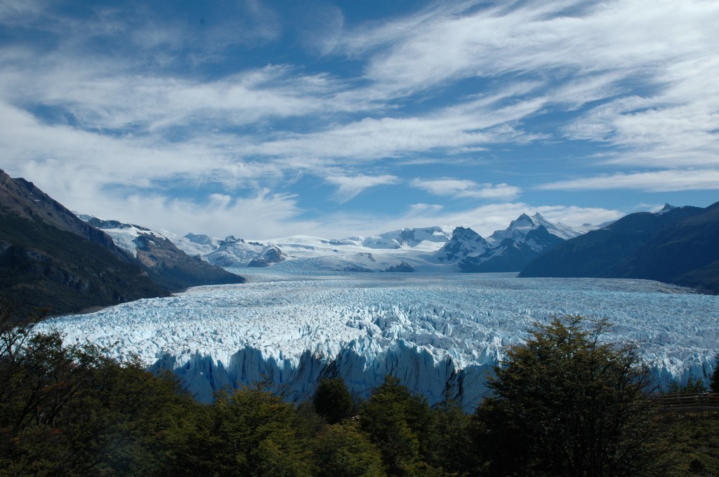
See that little gray rock outcropping in the middle back of the ice field (not the mountain in the background, the little jagged rocks with ice surrounding it). That point is 14 kilometers (almost 9 miles) from the front face of the glacier (which is in the foreground, partially hidden by trees). Here’s an overhead shot (complements of Wiki Commons) to give you an idea of how massive it is as the glacier fans out toward the shore.
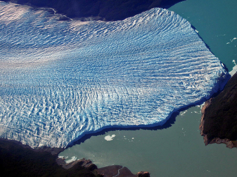
The front face in my photo is the tiny edge that touches the land on the right side of the Wiki photo. The lower face is the south face that I showed you above from the boat. But let’s go around to the north face (top right in the Wiki photo).
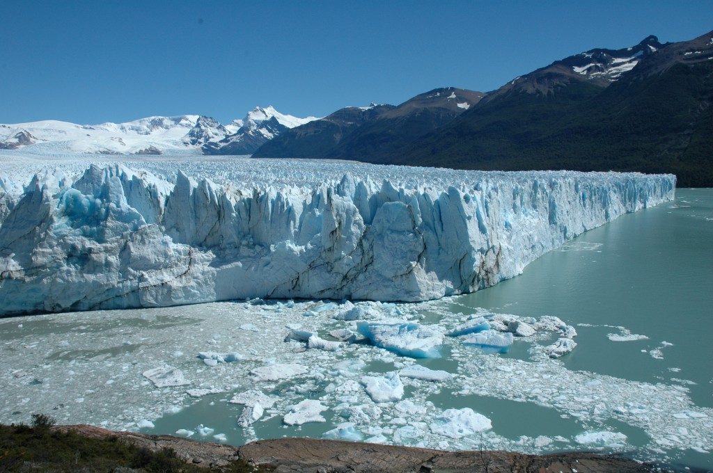
In the photo above you can see where the front face (left) meets the north face (right). By this time (mid-February) the front of the glacier had separated from the land (see the exciting video below). The icebergs in the water are from pieces of the glacier that have calved (broken off), a process that occurs sporadically but constantly as the glacier creeps towards us from the distant mountains. And just to remind you of the size, that shoreline in the right background? It’s about 2.5 kilometers away (1.5 miles).
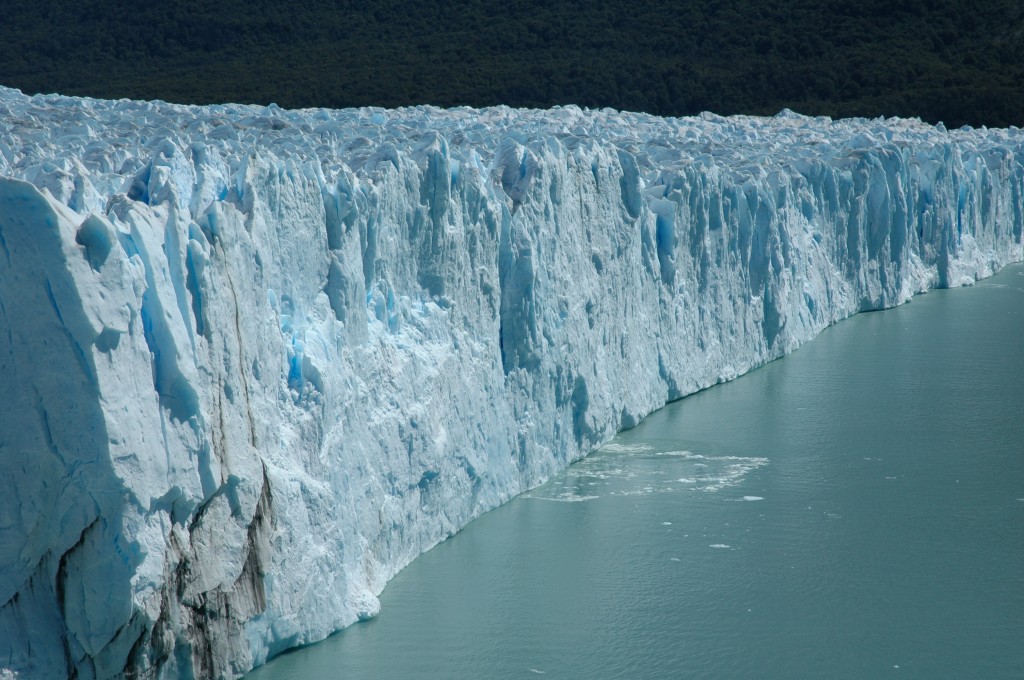
Okay, one more photo – a close up of the north face:
Since the name of this site is Science Traveler it’s virtually imperative that I mention the state of the glaciers in Argentina. The Perito Moreno glacier is one of 48 glaciers in the South Patagonia ice field (with many more in other ice field further north). Of those 48 glaciers, Perito Moreno is one of only three that is actually growing. Scientists aren’t entirely sure why this one is growing while 94% of the glaciers are shrinking, but any ice growth in an otherwise warming planet is good news [or not, since it’s likely the growth is due to changing weather patterns as a result of man-made climate change].
Another cool science bit for this glacier is the periodic rupturing it undergoes. Because of the unique flow pattern and geography of the region, the Perito Moreno glacier tends to push up against the shores of the Peninsula Magallanes (right in the Wiki photo). Usually the glacier melts back a bit during the summer (which was when I was there). But roughly every 4 to 5 years it creates an imbalance that results in a spectacular display. As the glacier blocks off the flow between the two arms of the lake, it raises the water level of the Brazo Rico as much as 30 meters (100 feet). The pressure caused by the weight of the water starts to strain the section of the glacier that has dammed it in. Eventually the ice is worn away enough to create an ice bridge. Slowly the combined stresses of forward moving glacier, downward water pressure, and seasonal melting cause big chunks (the house size) to fall out of the bridge. Until the whole thing collapses in a huge splash.
The last rupture in January of 2013, but the most magnificent rupture occurred in 2004 where, over the course of nine months, the ice dam formed, eroded, and eventually shattered. The video below documents the process.
I’ve provided only a handful of the many fantastic photos I took at the Perito Moreno glacier. I hope you got at least a small sense of the wonder of the location. It’s an experience I won’t soon forget. For more photos and stories of our trip to Argentina click here and scroll down.

Click to Barnes and Noble
Lincoln: The Fire of Genius: How Abraham Lincoln’s Commitment to Science and Technology Helped Modernize America is available at booksellers nationwide.
Limited signed copies are available via this website. The book also listed on Goodreads, the database where I keep track of my reading. Click on the “Want to Read” button to put it on your reading list. Please leave a review on Goodreads and Amazon if you like the book.
You also follow my author page on Facebook.
David J. Kent is President of the Lincoln Group of DC and the author of Lincoln: The Fire of Genius: How Abraham Lincoln’s Commitment to Science and Technology Helped Modernize America and Lincoln: The Man Who Saved America.
His previous books include Tesla: The Wizard of Electricity and Edison: The Inventor of the Modern World and two specialty e-books: Nikola Tesla: Renewable Energy Ahead of Its Time and Abraham Lincoln and Nikola Tesla: Connected by Fate.


Cool photos, sweet memories!!
A wonderful experience!
Far too cold for me. Beautiful though.
It was unbelievable to see close up.
Pingback: Revisiting Patagonia | Science Traveler
Amazing video! Apparently, something similar occurred at Lake Tahoe when the area was still glaciated. The lake would rise as much as 400 feet, then periodically drain very rapidly down the Truckee River watershed as the glacial dam collapsed.
The glacier is amazing to see. You can’t get a feel for how big an area it covers unless you see it in person. I took a boat out to the far side, then drove further along to get close up to the front face. Truly a great experience.
Pingback: The Southernmost Place I Have Ever Visited | Ru...