Yes, I said camels. More on that in a minute. As I’ve been documenting, Ru and I joined my friend Pablo and his two daughters Juli and Mica touring, trekking, and tripping down the eastern side of the Andes mountains of Patagonia, southern Argentina. One of our stops was the Cueva de las Manos…the Cave of the Hands.
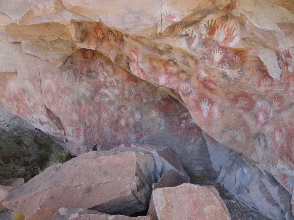
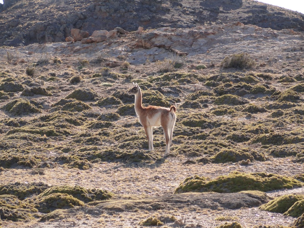
A UNESCO World Heritage site, the Cueva de las Manos is in such a remote location that it’s often missed by most casual tourists. Since driving all the way around to the main access road would take us over 150 kilometers out of our way, we decided to hike to it. After spending a night in a comfy log cabin, the five of us drove 17-km along a winding gravel road, along which we saw guanacos (WAN-a-coes), which look like short-haired llamas but, like the llamas, vicunas, and alpacas are actually closely related to camels.
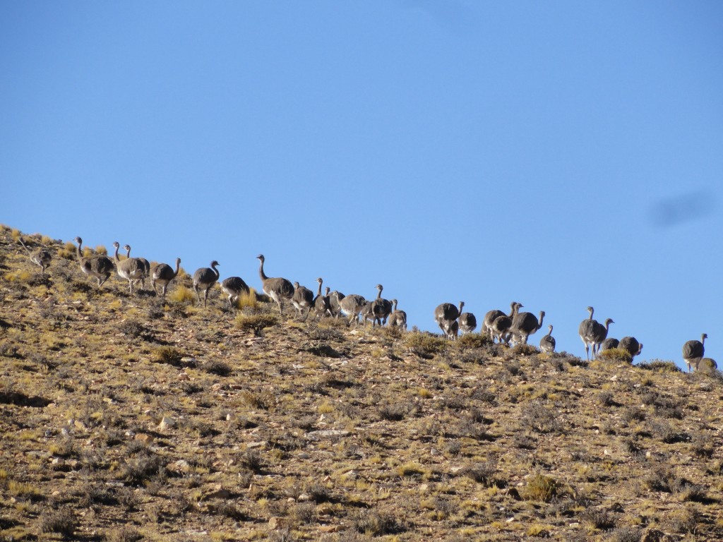
We also saw choiques (CHOY-kas), which are ostrich-like birds that people up north may have heard called rheas. I’ll have more on these and other Patagonian wildlife (including condors) in a future post.
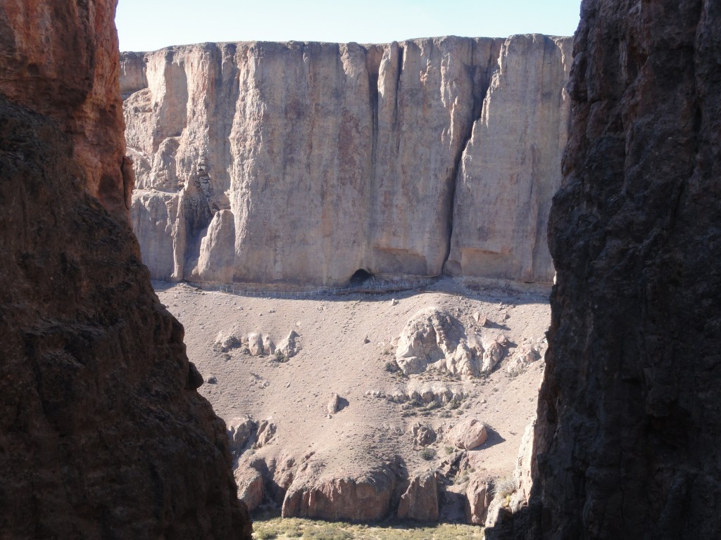
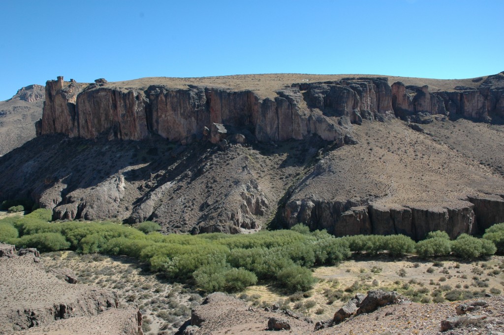
Eventually we arrived at the end of the road, but not the end of the trail, for where we were parked was on the opposite side of the valley from where we needed to be. So we hiked down this valley; that’s the cave peaking out from the other side.
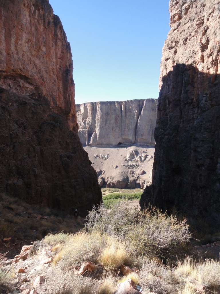
And a little closer…
Once on the other side we could see the valley we crossed. To give you perspective, the greenery in the center are full-size trees nestled along the Pinturas River. I admit we dallied in the wonderful shade they provided from the mid-day sun as we crossed a footbridge over the river.
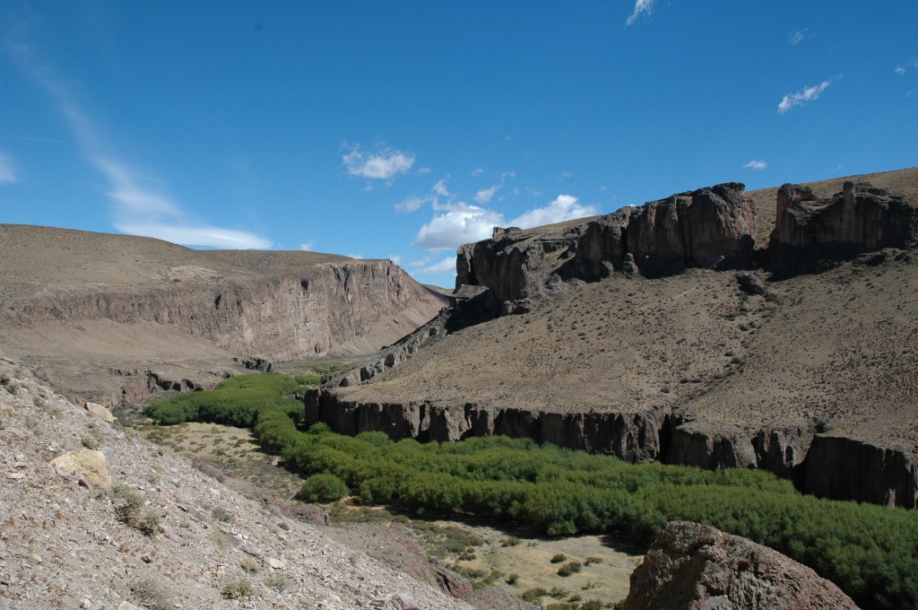
By the way, our car is at the top of that ridge on the right. But let’s not think about the return trip just yet. Let’s go see the cave.
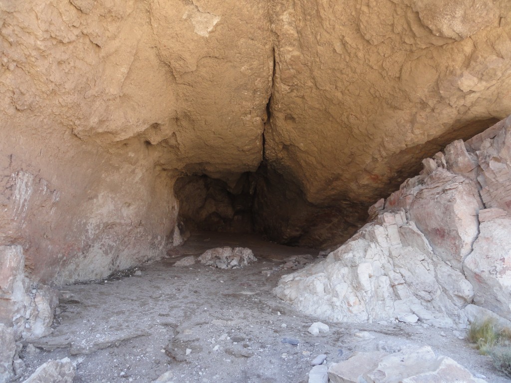
Okay, the cave itself is not so impressive. It’s about 10 meters high, 15 meters wide, and about 24 meters deep. It’s what is outside the cave that stirs the imagination. To get an idea of the layout, take a look at the photo below, which shows the valley and the cave system on the right wall.
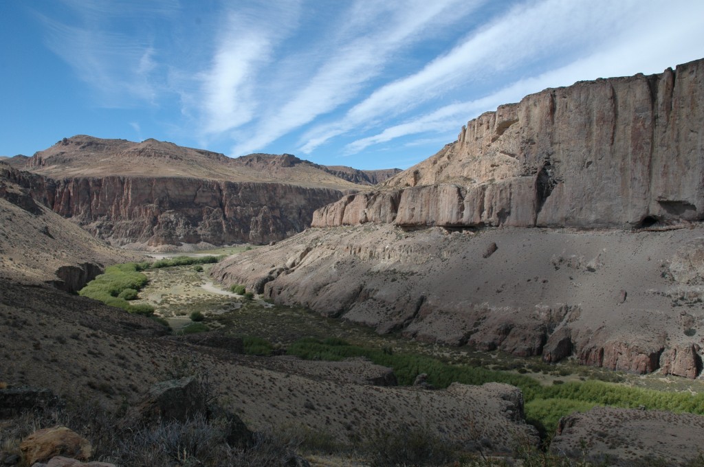
The main cave is the hole to the right about mid-way where the slope meets the cliff. However, following along what looks like a cut as you move left in the photo traces over 4000 years of history. And what you see is…hands.
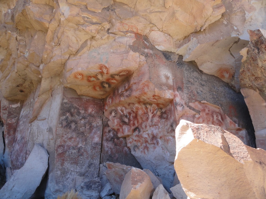
The hands are everywhere. At least three waves of indigenous peoples lived in this area, from about 9,000 years ago to as far as 13,000 years ago. The peoples were semi-nomadic, chasing their main food sources, the aforementioned guanocos and choiques, back and forth across the otherwise barren scrubland. To mark their ownership of the cave and environs they painted their hands onto the rock walls.
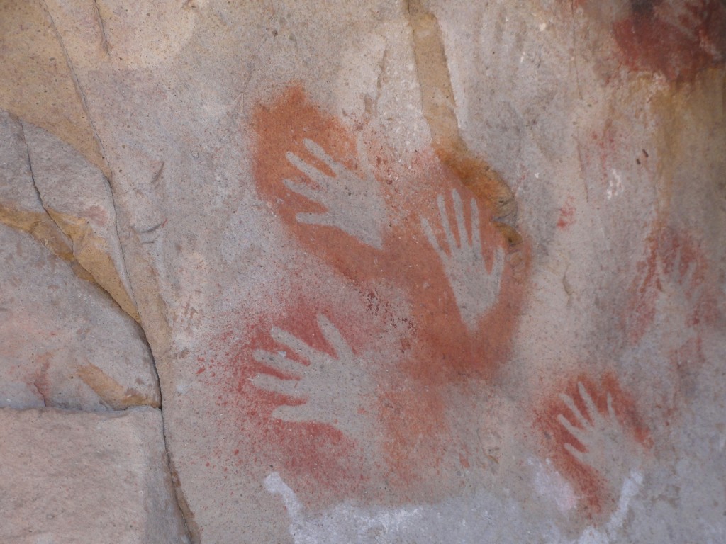
Painted is a bit of a misnomer. They actually stenciled negative images by holding their hands against the rock and blowing through a hollow reed a mixture of natural mineral pigments. The different colors were made by blending different base components – iron oxides (for red and purple), kaolin (for white), natrojarosite (for yellow), and manganese oxide (for black). Some unknown binder was added to get it to stick to the rock. Given that the hands are still visible after many thousands of years, one has to wonder whether the inhabitants had permanently painted mouths.
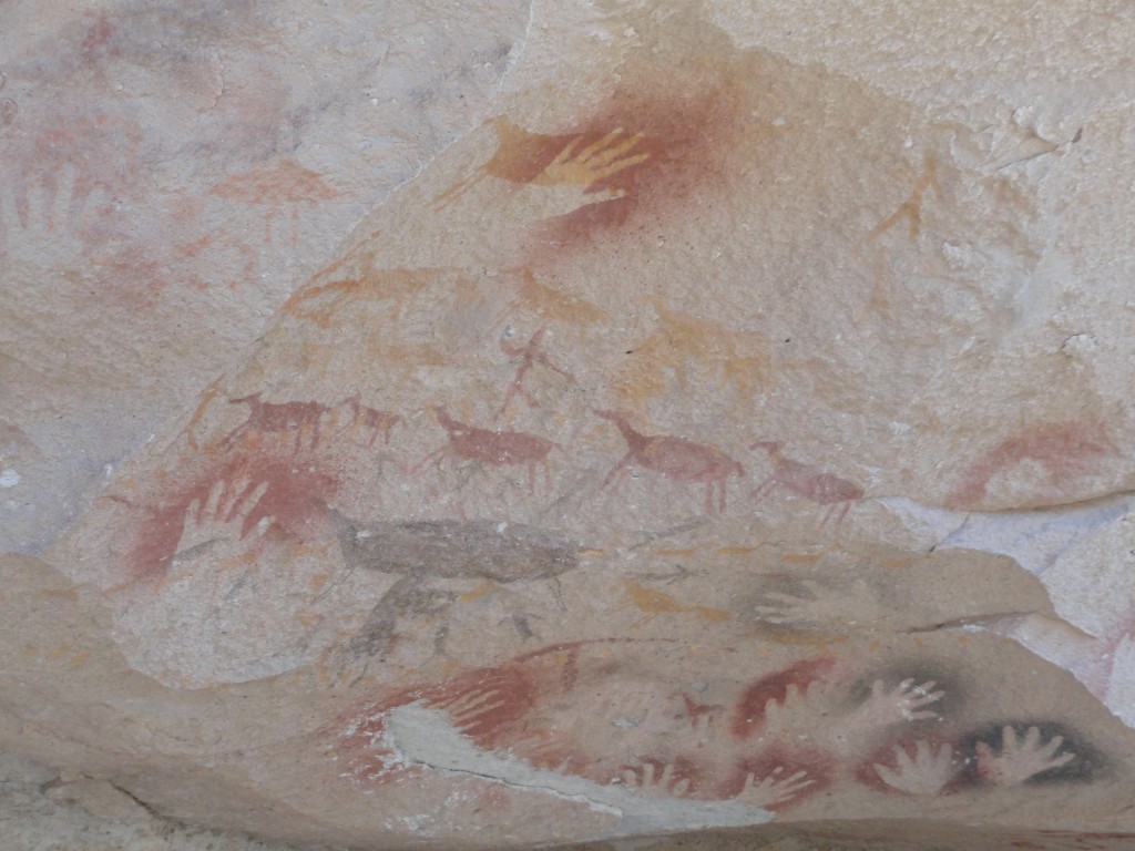
While most of the artwork depicts the artists’ hand (notice that most are the left hand, suggesting that they, like us, were predominantly right handed), as the photo above shows, they also painted guanacos. Needless to say they didn’t hold a guanaco up to the wall and do stencils, so these animals are directly painted as positive images (though I admit, a bit stylistically). For the occasional choique footprint, again they could hold up the three-toed appendage (presumably without the 90-lb bird still attached) and blow pigments to create a stencil.
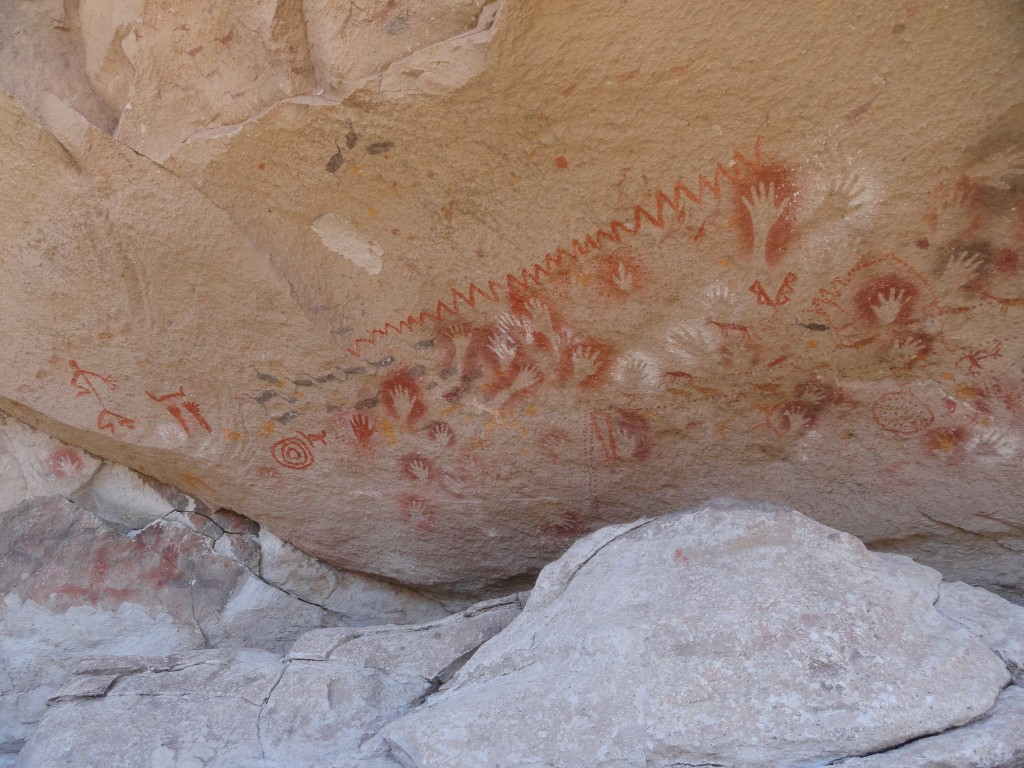
As I noted above, there were at least three waves of peoples who inhabited the caves over time. Initially you see only the masses of left hand stencils, but as you walk along the rock cut you see a gradual shift in the style and patterns of the artwork. More and more hunting scenes are visible, and near the far end you start to see stick-figure people, geometric shapes, and zigzag patterns.
Cueva de las Manos was a wonderful experience. The guide gave the tour in Spanish, but luckily Pablo and Juli took turns translating the highlights so we didn’t miss much (something to keep in mind if you travel down there without speaking the language). While the site is very remote, I wouldn’t have missed this for the world. Now, only one more trek left today. All we have to do is hike back down into the valley, then back up the other side. See those white specks at the top of the ridge (just right of center)? That’s our car. I’m glad I brought a hiking stick.
David J. Kent is an avid science traveler and the author of Lincoln: The Man Who Saved America, now available. His previous books include Tesla: The Wizard of Electricity and Edison: The Inventor of the Modern World (both Fall River Press). He has also written two e-books: Nikola Tesla: Renewable Energy Ahead of Its Time and Abraham Lincoln and Nikola Tesla: Connected by Fate.
Check out my Goodreads author page. While you’re at it, “Like” my Facebook author page for more updates!
Follow me by subscribing by email on the home page. Share with your friends using the buttons below.


