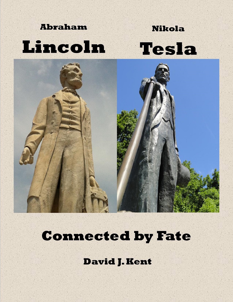
As I mentioned a couple of posts ago, I’m off Science traveling in Australia and New Zealand. Besides a tour inside the venue, here is a look at the famed Sydney Opera House from a harbor cruise.
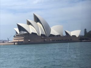
And at night.
Of course, I had to have breakfast with a koala. Say hi to Molly. I also hopped around with kangaroos, howled with dingoes, and hightailed with emus.

Sydney gave me my 46th aquarium and Cairns gave me my 47th.
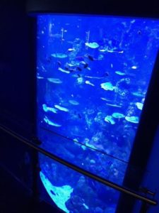
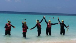
Then it was a sail out to the Great Barrier Reef and some snorkeling with the fishes and corals. I also hiked in the Blue Mountains.
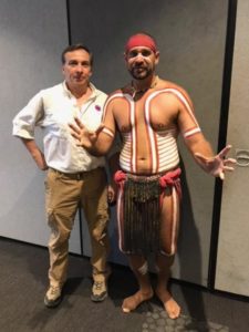
I even made a new friend. This is Wuru.
So much more to show you. I’ve moved on to New Zealand and its amazing mountain scenery. More photos soon.
Tag: Travel
Science Traveling Australia and New Zealand
I’ve always wanted to go to Australia and New Zealand, and soon I will achieve that goal. My upcoming trip will take a few weeks and cover a lot of terrain.
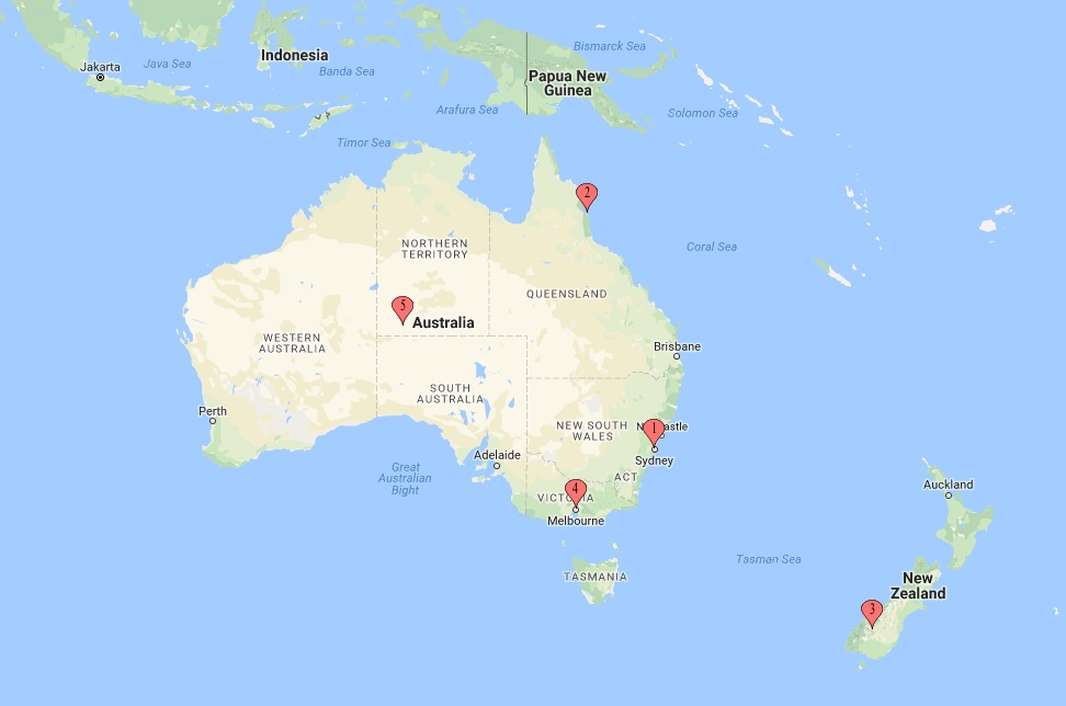
Keep in mind that Australia is roughly the size of the United States, so the distance from Sydney (#1 on the map above) to Cairns (#2) is equivalent to the distance from Florida to Montreal. Uluru, aka Ayer’s Rock, (#5) is about where Denver would be. Sydney to Queenstown, New Zealand (#3) would be about the distance from Washington DC to Caracas, Venezuela. Bottom line – each flight is a long way.
First stop is Sydney, so the famous bridge, the even more famous Opera House, and (of course) an aquarium. Plus cruising around the harbor, Bondi, and a tour of the Blue Mountains. From there it’s off to Cairns for the Great Barrier Reef, the Tjapukai Aboriginal Culture Park and more. I’m looking forward to seeing kangaroos, koalas, and kiwis.
The kiwi part will definitely happen after a multistep loop from Cairns through Auckland to Queenstown, New Zealand. We’ll see the wonders of Milford Sound and do a safari through Wakatipu while checking out the areas where the Lord of the Rings movie series was filmed.
But wait, there’s more. From Queenstown it’s back to Melbourne, Australia to check out another aquarium and drive south and west on the coast to see the 12 Apostles (of which there are only seven). Then back to Melbourne for a flight up to Uluru in the center of the country. I’ll need to drive the rental car on the left side of the road. Luckily I’ve done that in Scotland and Ireland so, well, fingers crossed.
From Uluru it’s back to Sydney to catch a long flight back home.
I’ll be updating on the trip whenever possible and will definitely have a ton of photos when I return. This will be my second big trip this year; the first was South Korea and Beijing in the spring. At that time the rumbling of missiles kept tensions high, and just this past week there was a series of earthquakes in New Zealand. Apparently there is a tectonic plate margin running right through the middle of the country.
Well, that’s what science traveling is all about, right.
David J. Kent is an avid science traveler and the author of Lincoln: The Man Who Saved America, now available. His previous books include Tesla: The Wizard of Electricity and Edison: The Inventor of the Modern World (both Fall River Press). He has also written two e-books: Nikola Tesla: Renewable Energy Ahead of Its Time and Abraham Lincoln and Nikola Tesla: Connected by Fate.
Check out my Goodreads author page. While you’re at it, “Like” my Facebook author page for more updates!
Follow me by subscribing by email on the home page. Share with your friends using the buttons below.
Irma’s Wreckage: Remembering Barbuda and St. Maarten
Hurricane Irma caused irretrievable damage to the very islands in the Caribbean we had spent many wonderful days on last year. We had met some amazing people on the trip and the devastation is hard to imagine.
Our first and last stops on an 8 day sailing cruise were St. Maarten, the Dutch side of the island. Watching the news and seeing how badly the French side was damaged was heartbreaking. I nearly lost it when I saw the photos of the St. Maarten airport. My preview of the trip included this article about how low the planes fly over the beach to land.
Now that famous beach looks like this.
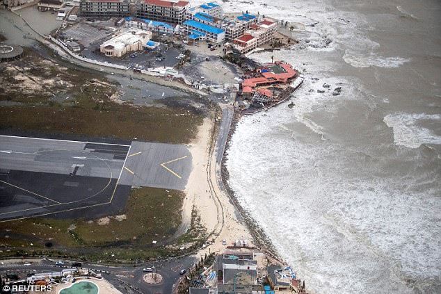
The area to the right is the ocean, the left is the approach to the runway. We had drinks at the bar where the shoreline meets those red-roofed buildings. The bar itself is no longer there. All that sand on the left side of the road, sprayed up on the end of the runway; that sand used to be a beach on the right side of the road. Now only rocks remain. Over in the central town, much of the area where we stayed in a small hotel along a restaurant-lined boardwalk and beach has been destroyed, or at least ravaged.
Another island we visited was Barbuda. It has an amazing frigate bird rookery, which I wrote about here. Before the storm the frigates outnumbered the human population of Barbuda. Today, Barbuda is uninhabited by people. Every single one of the 1800 people have been evacuated, mostly to Antigua.
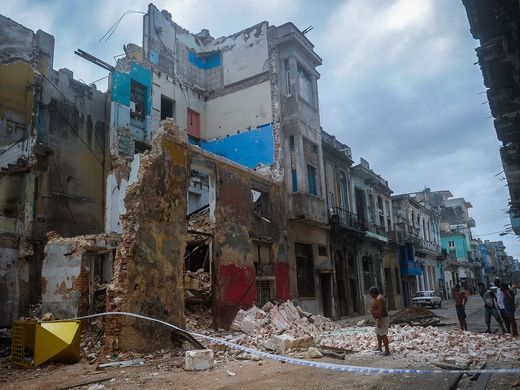
Virtually every building was damaged; most were destroyed. At this point I haven’t been able to find out how the frigate bird sanctuary fared.
Other islands we visited were also severely damaged by Irma. Hurricane Jose, following along right behind Irma, seemed at first headed for St. Maarten and Barbuda, but luckily veered north and spared them a second direct hit. It will be years before the islands are restored. For Barbuda, it might be never.
As heartbreaking as this is, I have fond memories of these islands. Once they recover I would like to visit again. I hope I have that chance.
David J. Kent is an avid science traveler and the author of Lincoln: The Man Who Saved America, now available. His previous books include Tesla: The Wizard of Electricity and Edison: The Inventor of the Modern World (both Fall River Press). He has also written two e-books: Nikola Tesla: Renewable Energy Ahead of Its Time and Abraham Lincoln and Nikola Tesla: Connected by Fate.
Check out my Goodreads author page. While you’re at it, “Like” my Facebook author page for more updates!
Follow me by subscribing by email on the home page. Share with your friends using the buttons below.
Reflections of a Science Traveler
 Today marks the fourth anniversary of resigning my consulting job to pursue a career science traveling. Recently I caught up with a former colleague who still works at the old firm. We hadn’t spoken in a long time so she asked me whether I had any regrets about my decision. Without a moment’s hesitation, I replied: “No regrets whatsoever.” I left with my eyes facing forward and have never once looked back on that former life.
My new life has given me plenty to behold, including more time to travel and write.
I generally add a few new countries to my list each year. This year had fewer trips but farther destinations. I was in Seoul, South Korea during the election of a new president (to replace the one impeached and indicted), all while North Korea was haphazardly tossing around missiles. Then on to Beijing, China, which was hosting over 30 world leaders (including Vladimir Putin) for the One Belt One Road Summit. Soon I’ll be in roaming around Australia and New Zealand. The 12-hour drive to and from New England squeezed in between these two exotic locations seems tame in comparison. Another New England trip and Gettysburg are likely in the fall.
Writing has included the release of my newest book, Lincoln: The Man Who Saved America. This is my third book with Fall River Press, all now in Barnes and Noble stores. I also have two e-books available on Amazon.com (see links at end). My first book, Tesla: The Wizard of Electricity, is going into its 8th printing this fall and has been translated into several foreign languages. Edison: The Inventor of the Modern World is still in stores and may also get a new printing soon.
Meanwhile, I’m working on two new books – one on a specific area of Abraham Lincoln’s interests, and the other a travel memoir (like Paul Theroux or Bill Bryson). By January I might have a third book in progress.
My former colleague also asked a second question: do I get to read a lot? In fact, that has been one of the unanticipated benefits. I’ve increased the number of books read from maybe 50 to over 100 books per year, and broadened my reading interests considerably. Traveling helps. While I don’t read much while I’m on the ground (where my time is spent exploring), the long flights and airport time are ideal for finishing off the latest novel or taking notes on various science, Lincoln, or biography books.
I also have time to do research. I spend some time at the Library of Congress and National Archives, plus make ample use of their online collections and other electronic resources. With nearly 1200 Lincoln books in my own home library, there is no shortage of background material. The travel itself is also research. I regularly incorporate in my books the knowledge gained while traveling, and future books will involve more travel-related topics.
This past several years I’ve been actively involved with the Lincoln Group of DC. As the Vice President of Programs I schedule speakers for our monthly dinner meetings and join the Board in planning – and participating in – a wide variety of other events. Next year I’ll, well, it’s still to be determined what I’ll be doing next year, but likely I’ll still be deeply involved in Abraham Lincoln.
So what will happen in 2018? My tentative plans include considerably more travel to places I’ve never been, including (I hope) to my 6th continent and beyond my 50th country. My writing goal is to finish the Lincoln science book so that it will be in stores no later than early 2019. I’m also piecing together a travel memoir tentatively titled Patagonia Summer that will combine travel, history, and science. The third possible book will likely be a compendium with my Lincoln colleagues. There is still some uncertainty in these plans as experience has taught me that “the best laid plans” often change dramatically.
One thing is for sure. No regrets whatsoever.
See my previous “Reflections” for 2014, 2015, 2016. I’ll likely do a final “reflections” next year on my fifth anniversary, after which I’ll skip to five or ten year reports. Who knows? Maybe I’ll be too famous to write by then. 🙂
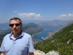
[Photo is at Kotor, Montenegro]
David J. Kent is an avid science traveler and the author of Lincoln: The Man Who Saved America, now available. His previous books include Tesla: The Wizard of Electricity and Edison: The Inventor of the Modern World (both Fall River Press). He has also written two e-books: Nikola Tesla: Renewable Energy Ahead of Its Time and Abraham Lincoln and Nikola Tesla: Connected by Fate.
Check out my Goodreads author page. While you’re at it, “Like” my Facebook author page for more updates!
Follow me by subscribing by email on the home page. Share with your friends using the buttons below.
One Belt, One Road, and the Hutongs of Beijing
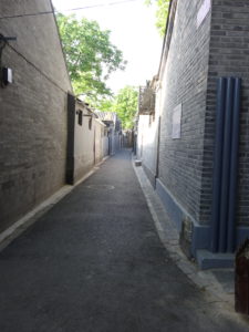 We thought we would try something different on this trip to Beijing. Rather than a western-style hotel we chose a small hotel in a traditional hutong. It was an experience I’ll never forget.
A hutong is an ancient alley dating back to the dynastic period of Beijing’s history. The word hutong is apparently derived from Mongolian, coined first during the Yuan Dynasty when Mongolian leader Kublai Khan controlled all of what is much of China, Korea, and parts of eastern Russian today. And alleys they are; narrow lanes with walls on both sides. Periodically you encounter a door, which leads to a central courtyard surrounded by tiny rooms in which various families live. These siheyuans line the hutong. Most of these siheyuans serve the poorer classes and lack toilets, which in modern times have been installed at points along the hutong and shared by all.
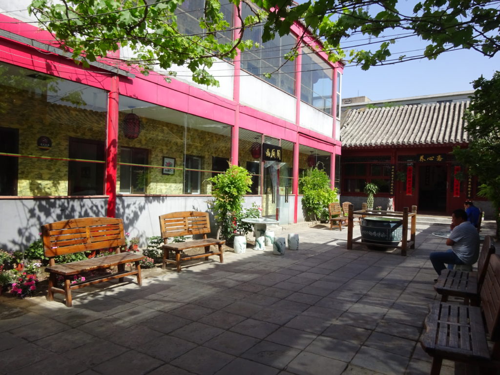
Our hutong hotel was on the upscale side, having been renovated to provide a larger than usual central courtyard and modern rooms (each with its own bathroom). Still, the rooms were tiny and the bathrooms were tinier. Late at night the locals just in from the outlying farms (in town to sell goods, perhaps) would arrive, their loud voices and arguments easily heard through the thin walls. Early morning risers added to the din, making sleeping an adventure.
For some reason we decided it would be a good idea to seek out our hotel in the darkened night of 10 pm. Ru’s sister met us at the nearby Ping’Anli Subway station and guided us to the hutong with her GPS. Without her we never would have found it, and the hutong entrance looked exactly like the kind of dark alley I would never (ever) have wandered down at night. After checking out the room she figured we were good for one night before changing our minds. We stayed five days, which shocked everyone, including us.
The One Belt, One Road Summit fell in the middle of our 10 days in Beijing. Proposed by Chinese President Xi Jinping, the One Belt, One Road initiative (OBOR for short) is a development project (call it a trade agreement) seeking cooperation between Eurasian countries. In town for the big meeting was Russian President Vladimir Putin and another 30 or so world leaders (nope, not the USA). Whenever bigwigs are in town the Chinese government shuts down factories and limits car driving in order to cleanse the normally thickly polluted air. We had beautiful clear blue sky for the entirety of our visit, a rarity. A few days after the OBOR meetings were over, the air had already started to get hazy again. It didn’t help that we had high 90 degree F temperatures for every day except two – and those two surpassed 100 degrees F.
After five days we decided that we had experienced enough of hutong life and got a room in a western hotel not far from the Beijing Book Building, a huge structure that makes the local Barnes and Noble stores look tiny. Down the road was Tiananmen Square and the Forbidden City, which was closed while the OBOR spouses toured. But that is a story for another time.
For those who want to experience a hutong without actually having to live in one, there are plenty of tours for foreigners offered by people roaming the usual tourist traps. One of the wider ones near the Bell and Drum Towers is called Nanluoguxiang and has been turned into a shopping street, but don’t mistake it for a real hutong. Wander off one of the side alleys to get a better flavor. Plan your walk to end up at Houhai, a beautiful lakefront road lined with plentiful bars and restaurants, all with live music.
Much more on Beijing and other travels on this page, so feel free to click around.
David J. Kent is the author of Lincoln: The Man Who Saved America, in Barnes and Noble stores now. His previous books include Tesla: The Wizard of Electricity (2013) and Edison: The Inventor of the Modern World (2016) and two e-books: Nikola Tesla: Renewable Energy Ahead of Its Time and Abraham Lincoln and Nikola Tesla: Connected by Fate.
Check out my Goodreads author page. While you’re at it, “Like” my Facebook author page for more updates!
Drum Tower of Beijing – Ancient Time Keeper
I recently visited the famous Drum Tower (鼓楼, Gulou) in Beijing, China. I was surprised to learn that it was also a clock, or at least a timekeeper. The tower, which faces its Bell Tower counterpart, was originally built when Kublai Khan was Emperor of China during the Yuan Dynasty (13th century). Originally used as a musical center, it later became a way for the reigning government to announce the time. The two towers maintained this official role up until 1924, when western style clockwork was adopted to keep time.
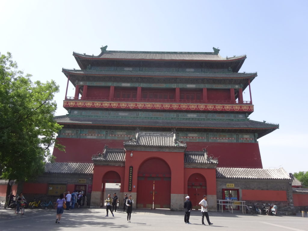
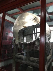
Climbing the long, steep stairway to the top gets you into the main room, one side of which holds a line of humongous drums. The one remaining original drum (of 25) sits to one side, its calfskin head slashed during the Eight Power Allied Forces’ invasion in 1900. We’re here to see the demonstration of the drums. While we wait we take in the panoramic view of Beijing from the outside walkway high above the streets.
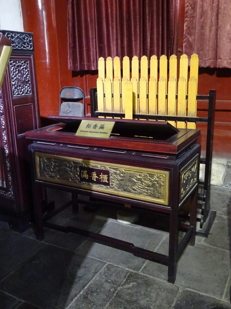
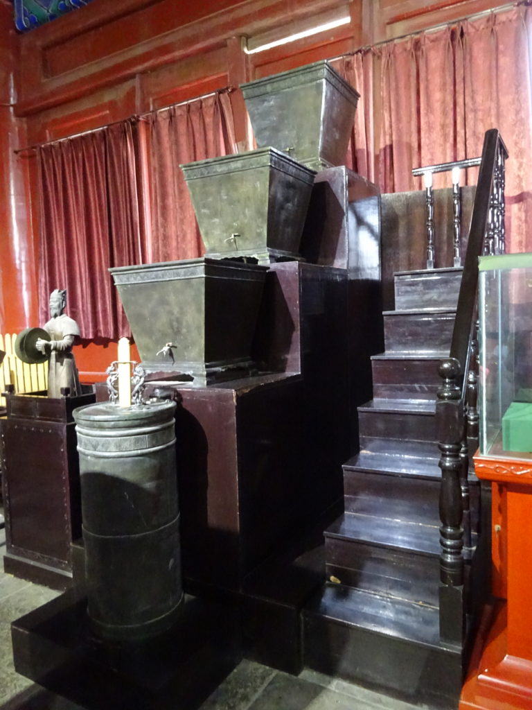
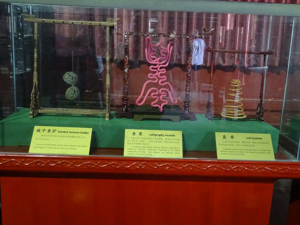
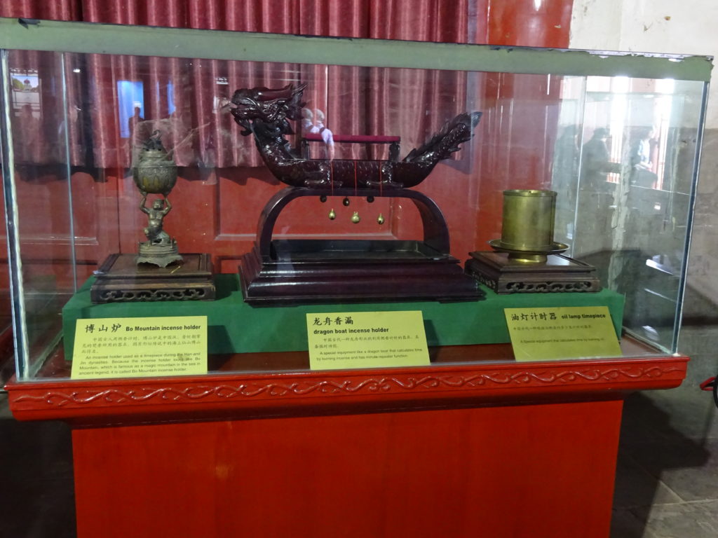
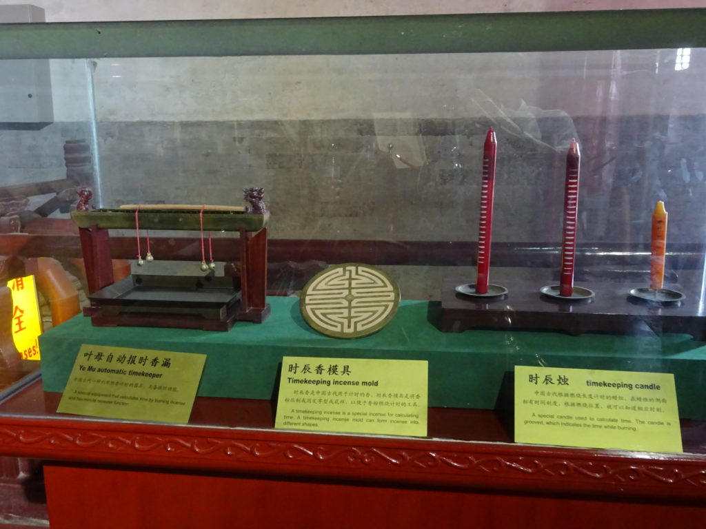
We also check out the displays of ancient timekeeping equipment. With our modern astronomically-linked smart phones and digital watches, it is interesting to see that much of time was monitored through the burning of incense and candles. Others used water or metal balls.
In one timepiece called a Bronze Kelou, time is measured by the flow of water through four copper clepsydras. A mechanical device would trigger the attached God of Cymbals to strike his cymbals together eight times for each quarter hour. Another timepiece called a Beilou contained several metal balls that would roll along copper pipe in a 2 meter tall cabinet. A ball would clang a cymbal every 24 seconds, thus it would take 14.4 minutes (an ancient quarter) for 36 metal balls to complete a cycle. It would take 24 hours for 3,600 metal balls to complete rolling, which gave relatively accurate time measurement.
It’s time. Four drummers march in and line up in front of the huge drums. They pound with such brute force it’s hard to imagine the drum heads lasting for very long. After only a few minutes you start to realize the power and strength of the drummers. Check out the video below.
After the demonstration we slowly descend the stairs, which somehow seem steeper going down than going up. This won’t be the last stairs – the even taller Bell Tower is next!
Meanwhile, check out my Goodreads author page. While you’re at it, “Like” my Facebook author page for more updates!
David J. Kent is the author of Lincoln: The Man Who Saved America, scheduled for release in summer 2017. His previous books include Tesla: The Wizard of Electricity and Edison: The Inventor of the Modern World (both Fall River Press). He has also written two e-books: Nikola Tesla: Renewable Energy Ahead of Its Time and Abraham Lincoln and Nikola Tesla: Connected by Fate.
Follow me by subscribing by email on the home page. And feel free to “Like” my Facebook author’s page and connect on LinkedIn. Share with your friends using the buttons below.
If It’s Tuesday – Networking, Networking, Networking
 Networking is your best friend!
In real estate they say “location, location, location.”
When moving to another country they say “network, network, network.”
In the continuing saga of my three-year long working life in Brussels (based on the movie, If It’s Tuesday, This Must be Belgium), one of my first concerns was the fact that I would not know anyone. How would I find a place to live? How would I deal with the foreign language? Buying groceries? The foreboding bureaucracy?
Who could I call on to help? After much thought and a whole lot of asking around, this is what I came up with to give me a hand as I prepared my international adventure.
1) The company office in Brussels: The obvious first stop was the European office of the company I worked for at the time. After all, company business was the reason I was getting this opportunity. I had met a few of my soon-to-be office mates when I attended a conference the year before, so had high hopes that they would be dragging me along to pubs and parties. That didn’t quite work out the way I anticipated (most had families and the requisite attention to those families), but they became a great resource for me.
2) Ex-Pat connections: No, these are not people who are no longer Patriot fans, but expatriates, who are people who live outside their native countries. Because Brussels is the capital of the European Union, there are networks of Americans (and Canadians and Aussies and Brits, etc) living and working in the city. While in the end I spent less time with native-English speakers than with other expats, it was nice to be able to sit in an Irish pub occasionally and hear mostly English-ish. A useful website to help locate expats is expat.com. [More below the photo]
3) Friends who have friends: Because of the global nature of many businesses these days, I’ve had a chance to meet people who work for multinational companies, international government agencies, and nongovernmental organizations. These groups were a great help in linking me with colleagues and friends in Brussels in particular or in Europe in general. Added to my own European friends, colleagues, and acquaintances, I started off this venture in pretty good shape. Or at least that’s what I thought.
4) Colleagues who have lived there: The firm I worked for had several partners who temporarily relocated from the Washington, DC to the Brussels office. Each of them in succession stayed only one year (I was there for three) and lived in a company-rented apartment (I needed to find and pay for my own apartment), but their experiences did give them wonderful insights, which they happily passed along to me.
5) Scientific organizations: I belong to, and have been active in, two major international scientific organizations. Both have European divisions, and the Executive Directors have helped introduce me to key folks in Europe. I had also been president of the regional chapters of both organizations, which helped my build a network of contacts, many of whom offered advice and strategies. [Others were simply envious of my opportunity and promptly invited themselves to stay with me at their earliest convenience.]
6) Social media: You guys! The assistance, support, and insights I received from online connections was invaluable. At the time I was active on a now-defunct posting and comment site called Gather, and the online friendships I had built all offered amazing support and suggestions. That site is gone but a large number of the people I formerly interacted with on Gather are now active connections on Facebook. I felt truly privileged to have “met” so many people who were willing to offer their experiences, travels, and passions to this project.
[Click and scroll for more in the If It’s Tuesday, This Must be Belgium series. More coming soon.]
Meanwhile, check out my Goodreads author page. While you’re at it, “Like” my Facebook author page for more updates!
David J. Kent is the author of Lincoln: The Man Who Saved America, scheduled for release in summer 2017. His previous books include Tesla: The Wizard of Electricity and Edison: The Inventor of the Modern World (both Fall River Press). He has also written two e-books: Nikola Tesla: Renewable Energy Ahead of Its Time and Abraham Lincoln and Nikola Tesla: Connected by Fate.
Follow me by subscribing by email on the home page. And feel free to “Like” my Facebook author’s page and connect on LinkedIn. Share with your friends using the buttons below.
Walking a Fine Line at the Korean DMZ
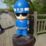 Recently, while North Korea was firing test missiles into the surrounding sea and China/South Korea tensions were heightened due to the THAAD controversy, I took a walk along the fine line that is the DMZ – the Demilitarized Zone between North and South Korea.
The area near the DMZ is anything but demilitarized, with armed guards stand at close firing distance from each other. Indeed, shortly after my visit South Korean soldiers fired upon what appeared to be North Korean drone flying over the border. Razor-wire fences line the road and river as you approach the DMZ, ostensibly to keep out invading forces, but in practice more to keep out spies and refugees floating down the river from the northern side of the border. The DMZ itself is a buffer zone, a strip of land extending 2 kilometers north and south of the border. Less than an hour from Seoul, we were able to get inside of the South Korean limits of the DMZ and go right up to the border itself.
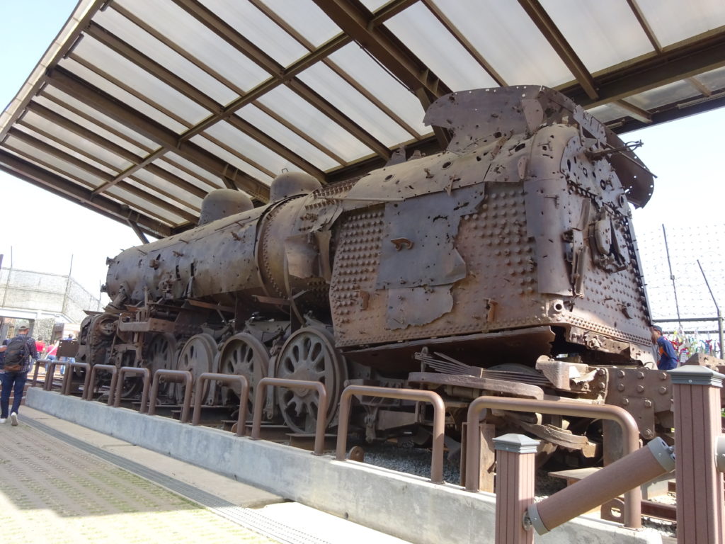
Our first stop was at Imjingak Tourist Resort, which was a weird combination of remnants from the war (shot up rusty steam locomotive engine, Freedom Bridge, monuments, etc.) and carnival rides and miniature golf course. It was designed as a sort of consolation to those who couldn’t return to their hometowns, friends, and families because of the split between North and South Korea.
From there we went to the “3rd tunnel of aggression,” one of four tunnels the North Koreans had built as potential attack routes. To reach this point we needed to go through a South Korean military checkpoint where soldiers checked our passports individually before we ran a gauntlet of zigzagged barriers, spiked blockades, and even more razor wire. On the way back out of the DMZ more soldiers checked our passports again to make sure we hadn’t left anyone behind.
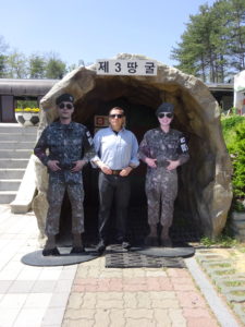 After seeing a video explaining the “3rd tunnel” and walking through a small museum, we donned hard hats for hike into the tunnel system. A long, steep access passage high enough to walk comfortably brought us steeply downward (358 meters long, 3 meters diameter, 11 degree angle) to a point where it intersected with the original tunnel of aggression. This “3rd tunnel” was very narrow (two people could barely squeeze sideways) with low ceilings (our hard hats dinged the ceiling routinely). Totaling 1,625 meters long, the 2 meter high and 2 meter wide tunnel sits 73 meters below the surface. About 1,200 meters of it is on the North Korean side of the demarcation (border) line, with 435 meters inside South Korea. We could walk hunched over about 265 meters, at which point a series of blockade walls keeps the two countries separated. Anthracite coal was painted on the walls and ceilings as a ruse; if discovered they could claim it was just a coal mine. Not a particularly credible feint given there is no coal in the region and the tunnel is cut through solid granite. While four tunnels have been discovered to date, it’s possible more exist. Photography was banned in the tunnels and everything but our clothes were required to be left in above ground lockers, so the photo above will have to suffice.

North (left) and South (right) Korean flags at DMZ
Our next stop was the Dora Observatory where we could see North Korea and its “propaganda village” and town and flag. Large binoculars give you a close up view. Both the North Koreans and South Koreans have placed their national flags on the tallest flag poles I’ve ever seen, dueling each other for psychological dominance while music plays over high-volume loudspeakers. The village looks like any other town from a distance, but the area just beyond the DMZ is flooded with thousands of artillery pieces. Experts believe about 60% of North Korea’s total artillery are positioned within a few kilometers of the DMZ. This is why it is so dangerous to American allies – any aggressive act by the US would within minutes result in thousands of shells raining down on Seoul, the capital and home to about half of South Korea’s 50 million citizens. In case you missed that, an attack on North Korea would immediately result in the deaths of up to 25 million South Koreans. Not a particularly strong bargaining position.

From there we went to the Dorasan Station, a Metro Subway Station that was built inside the DMZ just short of the North Korean border in the hopes that some day there would be a reuniting of the two countries (or at least a working relationship). Trains come this far only once a day. Here we put two inked stamps that look like passport visas onto the brochure for the DMZ (we were careful not to stamp our passports since 1) they aren’t official, and 2) we were headed to Beijing next. As it was, China only allowed me a one-entry, 30-day visa on this trip because we were going to South Korea first.
The DMZ offered a unique experience that gave me new insights into the conflict and the difficulties of resolving the issue even today. Critically, while an armistice was agreed to in 1953, no peace treaty was ever signed and the North and South are still technically at war. [Interestingly, after my return to the US I went to a lecture by Alan Alda, who played Hawkeye Pierce in M*A*S*H, set in Korea during the Korean war]
One other shocking experience occurred on this trip: on the way back to Seoul we saw a huge full size cruise ship high on the hill overlooking the road. But that is a story for another day.
David J. Kent is the author of Lincoln: The Man Who Saved America, in Barnes and Noble stores now. His previous books include Tesla: The Wizard of Electricity (2013) and Edison: The Inventor of the Modern World (2016) and two e-books: Nikola Tesla: Renewable Energy Ahead of Its Time and Abraham Lincoln and Nikola Tesla: Connected by Fate.
Check out my Goodreads author page. While you’re at it, “Like” my Facebook author page for more updates!
A Little Bit of Jagalchi Fish Market, Busan, South Korea
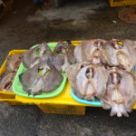
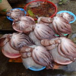
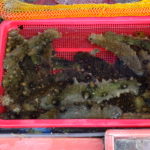
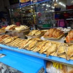
Like fish? You better if you travel to Busan, South Korea. And the place to be is the Jagalchi Fish Market, the biggest fish market in all of Korea. When I say big, I mean huge. Do not miss it.
Busan (as it has been named officially since 2000 to avoid the unpleasant sound of its original name, Pusan) is South Korea’s second biggest city, weighing in at about 3.6 million people. Sitting on the southeast coastline, Busan is know for its grand beaches, mountainous parks, ancient temples, and, of course, an aquarium.
One of Busan’s biggest attractions is the fish market. Located in the Nampo-dong neighborhood along the waterfront, the rather surprising main building takes up several floors behind a wall of glass. The first floor is lined with row after row of fresh seafood, much of it still alive and waiting to be chosen for tonight’s dinner. The second floor has a restaurant and a dried fish market. Upper floors hold an exhibition room, another restaurant and seafood buffets, and oddly enough, a guesthouse and sky park.
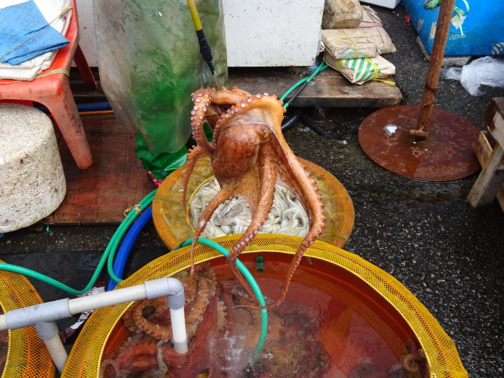
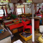
But to me the much more interesting part of the fish market is the one outdoors. Stretching down a narrow lane from the front doors of the building are hundreds of small vendors selling every kind of seafood you can imagine. Some of it is mobile like this octopus (above) that almost made a getaway before being snagged up by the vendor and returned to his not-so-private temporary swimming pool.
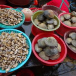
Not to be outdone, each vendor tries to lure you into their stand by hyping their specialties – live hagfish, clams, sea cucumbers, whelk, mackerel, pompano, belt fish, skate, lobster, several species of crabs, and some things that I still can’t identify despite my old marine biology training.
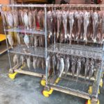
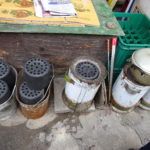
If you don’t want live fish, or those freshly departed, you can find every variety of dried fish and squid to gnaw on. A few stalls sell precooked fish as well. Hungry now? Many of the outdoor stalls have mini-restaurants tucked in behind their display tables where they will be happy to whip up a freshly cooked (and killed) morsel of your choice on the ubiquitous compressed coal open stoves. Don’t know what to order? Choose the pre-made variety dishes for a delicious hot pot. Don’t forget the vegetables (you can buy those here too).
You can get to Jagalchi by taking Line 1 of the Busan subway system to Jagalchi station. Take Exit 10 and head for the waterfront.
There is so much more to see in the Busan. Stay tuned.
David J. Kent is an avid science traveler and the author of Tesla: The Wizard of Electricity and Edison: The Inventor of the Modern World (both Fall River Press). He has also written two e-books: Nikola Tesla: Renewable Energy Ahead of Its Time and Abraham Lincoln and Nikola Tesla: Connected by Fate. His next book, Lincoln: The Man Who Saved America, is scheduled for release in summer 2017.
Follow me by subscribing by email on the home page. And feel free to “Like” my Facebook author’s page and connect on LinkedIn. Share with your friends using the buttons below.
A Visit to the Bergen Aquarium
On the far west coast of Norway is the city of Bergen, home of the Akvariet i Bergen, the Bergen Aquarium. The aquarium is surprisingly good, and definitely worth the visit.
Most people arrive in Bergen at the end of a long train line extending through the mountains and fjords from Oslo, but you can also arrive by ship or its well-traveled airport. After arrival you’ll want to take the funicular up Mount Floyen for a bird’s eye view.

Though seemingly small, Bergen actually is a fair sized city of over 275,000 people, so you might want to take a taxi or bike out to the end of the Nordnes peninsula, though it is walkable on a nice day. Your first site upon entering the aquarium is an open air seal show and some of the nicest Gentoo penguins you’re ever going to meet.
The aquarium has the usual array of tropical fish and seaside habitats. What makes it unique is its displays of North Sea and coldwater species. I was particularly drawn to the wolffish, whose huge teeth and massive jaws are perfect for its normal diet of hardshell molluscs (whelks, cockles), sea clams, crustaceans, and echinoderms (like starfish and sea urchins). Wolffish also carry a natural antifreeze to keep their flood flowing in their frigid environment.
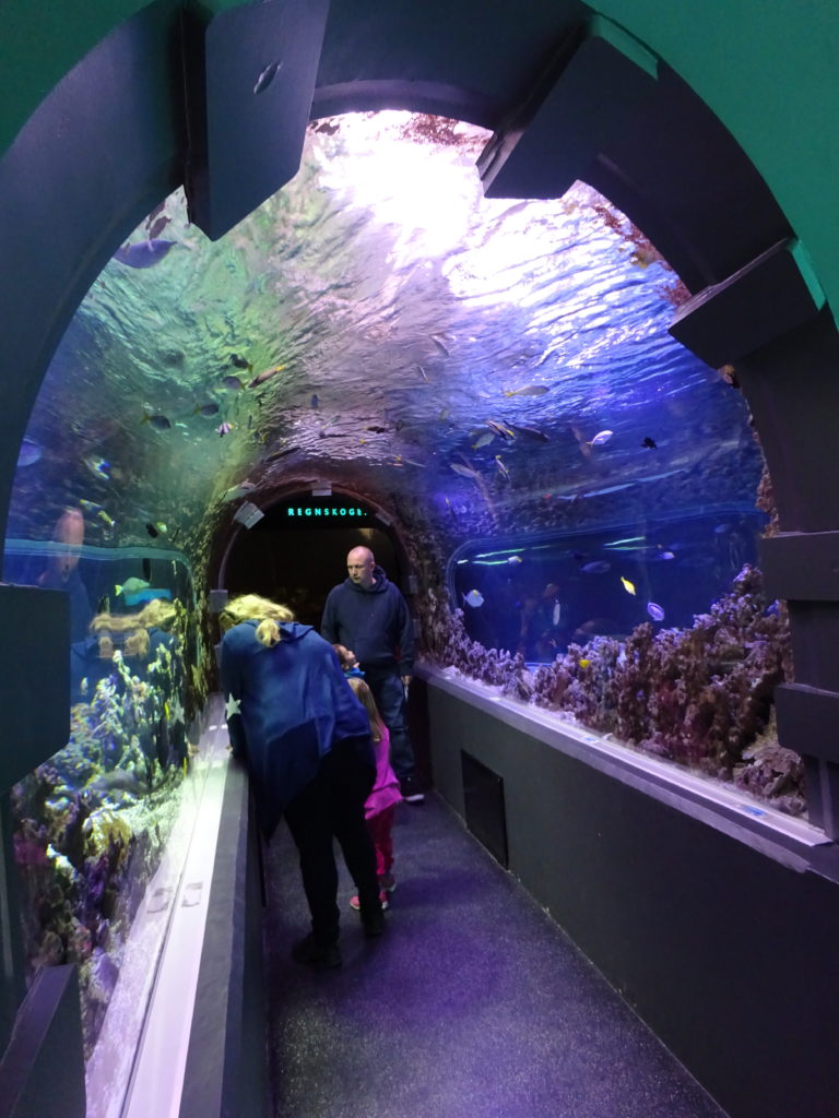
At less than 30-feet long, Bergen has the shortest underwater tunnel I’ve ever seen in a public aquarium. A quick glimpse at the handful of sharks, rays, and tropicals and you’re done. They make up for it by having an extensive collection of Nile crocodiles, caiman, and iguanas.
While I admit my expectations were low, I found the Bergen Aquarium to far exceed what I had anticipated. The aquarium was considered the largest and most modern aquarium in northern Europe when it opened in 1960. That may or may not still be true depending on what you count as northern Europe, but this is certainly the most northern aquarium I’ve visited (followed closely behind by the Stockholm Aquarium, which I saw on the same trip).
Either way, the Bergen Aquarium is worth seeing. I recommend doing what I did and take the scenic train/boat/train from Oslo through the mountains and fjords.
David J. Kent is the author of Lincoln: The Man Who Saved America, in Barnes and Noble stores now. His previous books include Tesla: The Wizard of Electricity (2013) and Edison: The Inventor of the Modern World (2016) and two e-books: Nikola Tesla: Renewable Energy Ahead of Its Time and Abraham Lincoln and Nikola Tesla: Connected by Fate.
Check out my Goodreads author page. While you’re at it, “Like” my Facebook author page for more updates!


